 NomadSwipe
How to turn a list of saved places into a day-by-day itinerary
Here is how to turn a list of saved places into a day-by-day itinerary: group the places by map position, check which weekdays each is open, then order each day's stops. Coordinates alone matched my own day split for 62 of 77 stops in five city plans.
The five steps at a glance
A saved list is a pile of pins, not a plan. The jump from one to the other is mostly three questions: which places are near each other, which are open on the days you will be there, and in what order you walk them. This is the order I work in.
| Step | Do this | What it settles |
|---|---|---|
| 1 | Put every saved place in one list with its address | One source to work from |
| 2 | Open the map and drop pins that sit in the wrong place | A list that is really about one city |
| 3 | Split the pins into one cluster per day | Which places can share a day |
| 4 | Test each cluster against the weekdays you will be there | Which closed doors need a swap |
| 5 | Order each day: fixed hours first, food nearby, one direction | The actual sequence |
Step 1: get everything into one list
Saved places end up scattered across screenshots, notes and a map app, so first pull them into one list. If you use Google Maps, its help page for lists describes saving a place by searching for it or tapping it on the map, tapping its name or address at the bottom, tapping Save and choosing a list, and it says a Private list can only be viewed and edited by you. The same page describes reordering the places in a list: turn on "Customize list order" and "touch and hold the four blue lines to the left of the place title." I did not find grouping by day anywhere on that page, so the day split is yours to make. The click-by-click version is in how to save places on Google Maps for a trip.
Whatever the tool, keep each place's address and, where you can see it, its opening days. Steps 3 and 4 depend on both. If you are still choosing a tool, free itinerary planner apps and best trip planner apps for 2026 compare them, and Google Maps lists alternatives covers the case where lists feel too flat.
Step 2: drop the pins that sit in the wrong place
Open the map before you cluster anything. A pin hundreds of kilometres away will wreck any grouping, and it happens: I checked the cards in six NomadSwipe city decks that are sights (a museum, park, landmark or similar type) with a rating of at least 4.3 and at least 300 reviews, and measured each against the deck's stored centre point.
| City deck | Sight cards in the filter | More than 50 km from the centre |
|---|---|---|
| Chicago | 13 | 0 |
| Lisbon | 15 | 0 |
| Minneapolis | 13 | 0 |
| Yerevan | 8 | 0 |
| Sedona | 17 | 5 |
| Vienna | 7 | 4 |
| All six | 73 | 9 |
The far cards in the Sedona deck include the Las Vegas Strip and Chihuly Garden and Glass, and the Vienna deck holds US botanical gardens and a US zoo. They are real places on the wrong side of the world for these trips. A far pin is either a slip to delete or a day trip to keep apart, so decide which before you cluster. Some places are far on purpose: the Chicago Botanic Garden is a real card in the Chicago deck, about 33 km from the Art Institute by straight line, and it behaves like a day trip, not a stop.
Step 3: split the pins into one cluster per day
You do not need an algorithm to do this. Look at the map and draw a loop around each group of pins that you could walk or ride between in a few minutes. One cluster per day, and if one pin sits alone, it is a day trip or a candidate to cut. To test whether the by-eye idea holds, I ran a deliberately dumb version on real plans.
I took the stops from five of my published 2-day plans, threw away the day labels, and let a simple k-means split (two groups, started from the two farthest stops, straight-line distance) assign them to two days using coordinates alone. Then I compared its split with the day split I had written by hand.
| City plan | Stops found in the app | Median km apart, day 1 | Day 2 | Both days pooled | Coordinate split matched |
|---|---|---|---|---|---|
| Chicago | 16 of 16 | 1.1 | 1.0 | 3.1 | 16 of 16 |
| Lisbon | 14 of 16 | 0.8 | 4.7 | 3.4 | 9 of 14 |
| Minneapolis | 15 of 15 | 1.2 | 3.4 | 2.4 | 11 of 15 |
| Sedona | 15 of 15 | 5.6 | 3.4 | 4.6 | 12 of 15 |
| Yerevan | 17 of 17 | 0.7 | 1.5 | 1.2 | 14 of 17 |
| All five | 77 of 79 | 62 of 77 |
Two readings. First, coordinates do most of the work: the split matched my own day for 62 of 77 stops, and exactly for all 16 in Chicago. Second, they do not do all of it, so use the clusters as a first draft. In Lisbon the by-hand day two reaches from the Palácio Nacional da Ajuda to the Oceanário, 11.0 km apart, and the coordinate split disagreed with my day for 5 of the 14 stops. I did not dig into why each mismatch happened. The plans also weigh meals, opening hours and my own taste, and the split does not.
Distances are straight lines between stored coordinates, not walking times, and the stops include meals and drinks, not only sights.
Step 4: check opening days for each cluster
Once a cluster is a day, test it against the weekday it will fall on. The opening days stored in NomadSwipe come as one line per weekday, so a place stored as closed on Tuesday is easy to spot. This is the same check I made on the five plans:
| City plan | Stops with stored hours | Closed Monday | Closed Tuesday |
|---|---|---|---|
| Chicago | 14 of 16 | 2 | 2 |
| Lisbon | 6 of 14 | 1 | 2 |
| Minneapolis | 12 of 15 | 3 | 2 |
| Sedona | 12 of 15 | 0 | 0 |
| Yerevan | 14 of 17 | 5 | 0 |
| All five | 58 of 77 | 11 | 6 |
Of the 58 stops with stored hours, 11 (19%) show Monday as closed and 6 (10%) show Tuesday as closed. Those are low estimates for a random list, because I had already built each plan around these hours. The other 19 stops (25%) have no stored hours, so I cannot test them: check those on the place's own page. In Lisbon only 6 of 14 stops have stored hours, which is why that plan leans on the later check. Stored hours are a snapshot and public holidays change them. The weekday patterns across more cities are in how to plan a weekend city break.
When a day fails, swap one place for another stop in the same cluster, not for a place across town. That keeps the day's shape and fixes the closed door.
Step 5: order each day
This is my own rule of thumb, not a standard. Put the stop with the tightest opening hours first, then the lunch or coffee place closest to it, then work in one direction so you never walk back past a place you skipped. In my Chicago in 2 days plan, day one starts at the Field Museum at 9:00, when it opens, and its stops end up no more than 3.0 km apart in a straight line. Put anything with no stored hours late, where a closed door costs the least. For a map-first version of this whole routine, see how to plan a trip on a map.
Doing it in NomadSwipe
I built NomadSwipe (Android) to cover the front half of this process. You open a city and swipe real places: a card shows its category, rating, distance and opening status, swipe right or tap Save to keep it. Saved places go into a trip, and you can see the trip on a map, where the clusters from step 3 show up, and as a list sorted by rating, distance or A to Z. You can add a custom pin for something that is not a card, such as your hotel. I make no claim that it builds the days for you: the order of each day is yours to set from the map, using steps 3 to 5.
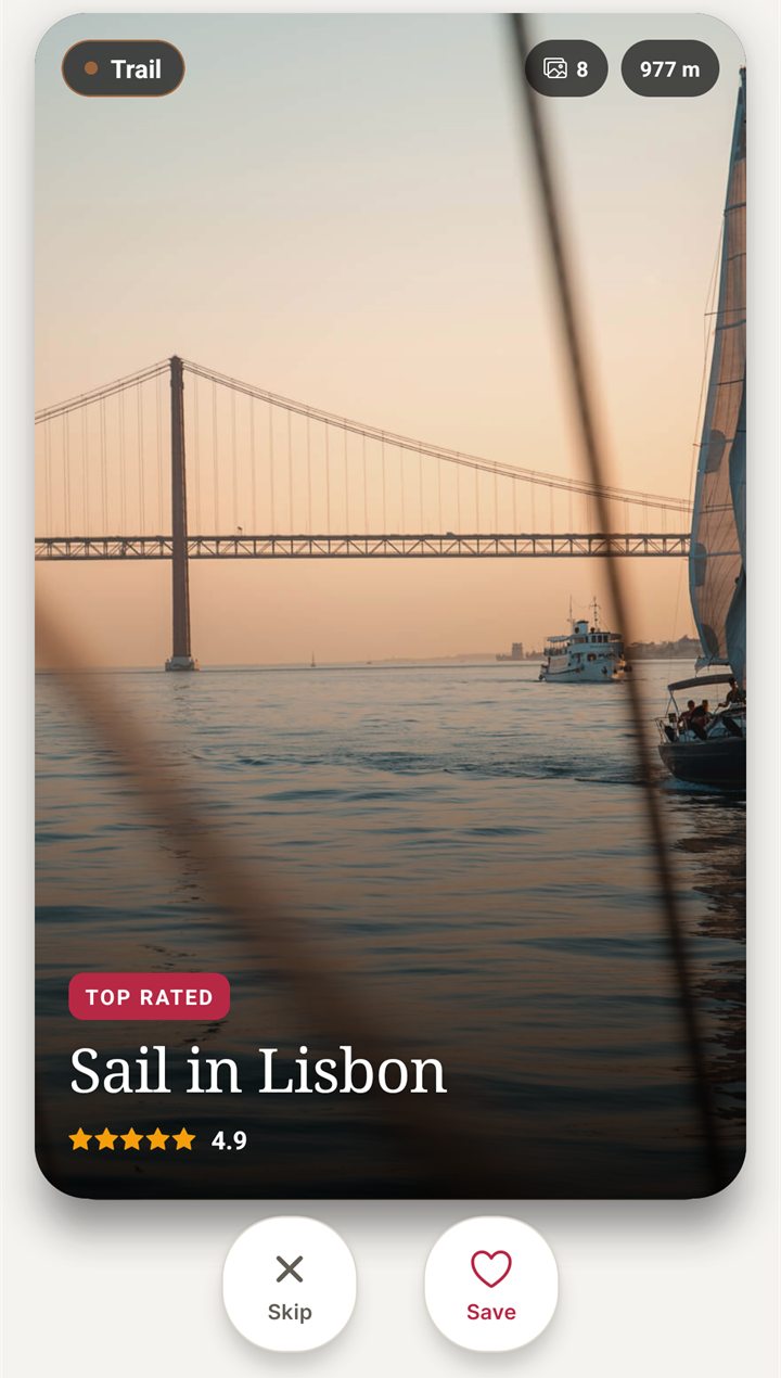
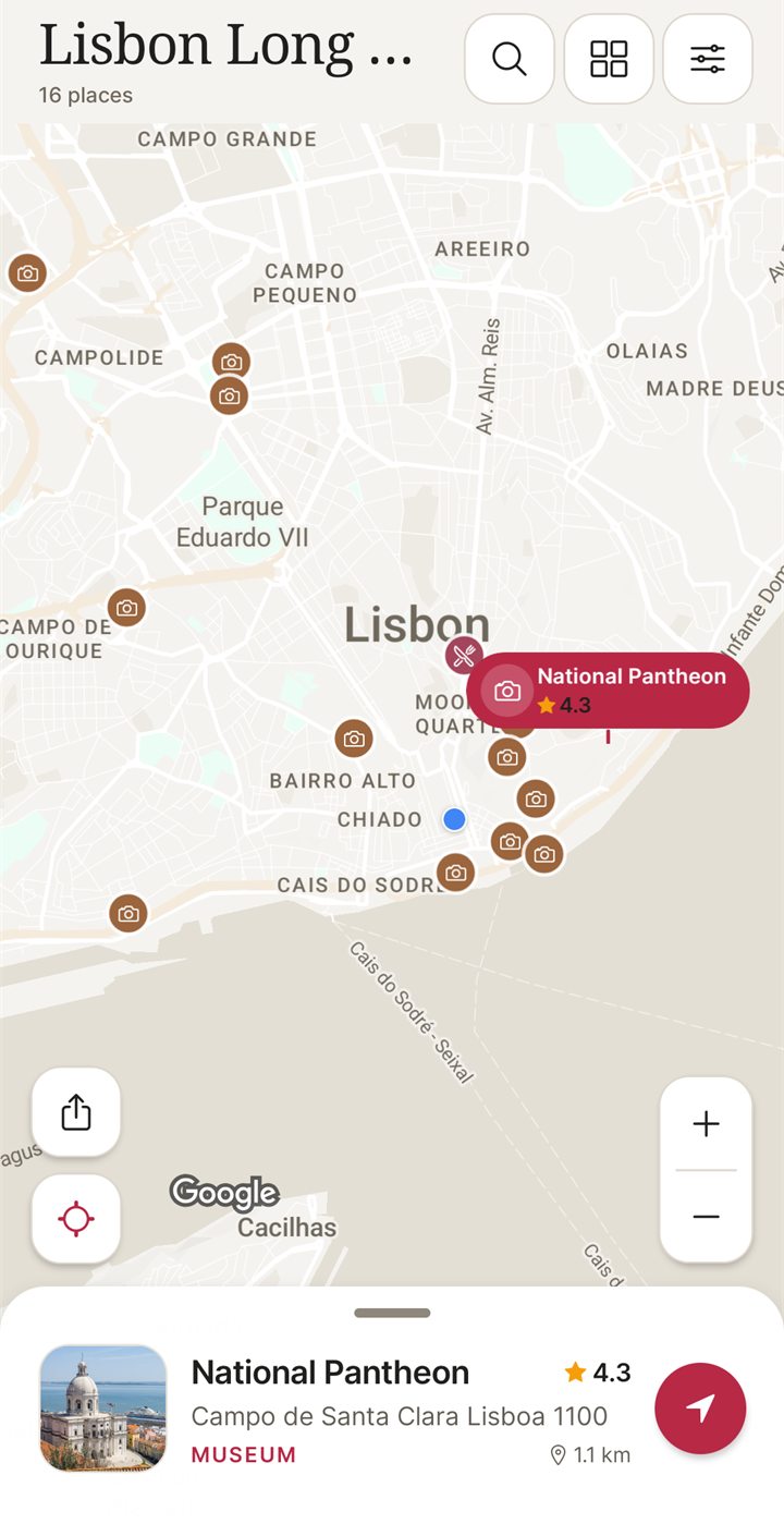
The Lisbon sample trip, 16 places picked by swiping, is walked through in Lisbon in 2 days. The five plans above show the whole method on real data, and swipe travel apps for Android compares this approach with others.
Questions about turning saved places into an itinerary
How do I turn a list of saved places into a day-by-day itinerary?
Group the places by where they are, one cluster per day, then check each cluster against the weekdays you will be there and order the stops. In five of my 2-day city plans, a coordinates-only split into two days matched my own split for 62 of 77 stops, so use it as a first draft and adjust by hand.
How many places should go in one day?
My 2-day plans put 6 to 10 stops in a day, counting meals and a drink: Chicago has 9 and 7, Lisbon 8 and 6 found in the app, Yerevan 10 and 7. That is my own choice, not a rule. The stops on the longest days were still within about 3 km of each other in Chicago and Yerevan.
How do I save places on Google Maps for a trip?
Per Google's help page, search for the place or tap it on the map, tap its name or address at the bottom, tap Save, and choose or create a list. You can make a list Private, so only you can view and edit it, and reorder it with "Customize list order". I did not find a grouping-by-day feature on that page. The steps are in saving places on Google Maps for a trip.
What is the best app to plan a trip?
It depends on whether you want a day-by-day scheduler, a map of saved places or a booking tool, and I only know my own app well. See best trip planner apps for 2026 and free itinerary planner apps. NomadSwipe covers swiping, saving and the map. I make no claim that it builds the days for you.
What if a saved place is closed on the day I planned?
Swap it for another stop from the same cluster, not for something across town. In the five plans I checked, 11 of 58 stops with stored hours show Monday as closed and 6 show Tuesday as closed, so a Monday or Tuesday trip usually needs a swap or two. Check the place's own page for the final answer.
Swipe a shortlist for your next trip
I built NomadSwipe (Android) to swipe real places in a city, save the ones you like and see them on a map. Then use the five steps above to split them into days.
Findings, method and sample
Sample and method. I read the NomadSwipe app's place data on 7 November 2026 with read-only queries. The five plan tables use the stops listed in my published 2-day guides for Chicago, Lisbon, Minneapolis, Sedona and Yerevan (79 stops). I found each stop's card by its title within that city's deck, case-insensitively, keeping the card with the most reviews, and used its stored latitude, longitude and weekly hours. The Chicago Cafecito stops were matched by address because the deck holds three Cafecito cards. Two Lisbon stops, Cinemas NOS Amoreiras and Cervejaria Ramiro, matched no card title, so 77 stops are in the tables. A stop counts as having stored hours only if it has all seven weekdays listed, and as closed on a weekday if that line reads Closed. Distances are straight lines (haversine) between stored coordinates. The coordinate split is a two-group k-means started from the two farthest stops, written for this page, with the better of the two ways of labelling its groups as day 1 and day 2 counted as a match. The sight-card table uses cards of a sight type with rating of at least 4.3 and at least 300 reviews, measured against each deck's stored centre point. I counted cards, not merged venues.
- Across five plans, a coordinates-only split into two days matched my hand-made split for 62 of 77 stops: Chicago 16 of 16, Yerevan 14 of 17, Sedona 12 of 15, Minneapolis 11 of 15 and Lisbon 9 of 14.
- The median straight-line distance between a day's stops runs from 0.7 km (Yerevan day 1) to 5.6 km (Sedona day 1). In Chicago the day medians are 1.1 and 1.0 km against 3.1 km with both days pooled.
- Of 77 stops, 58 (75%) have stored hours. Of those, 11 (19%) show Monday as closed and 6 (10%) show Tuesday as closed. Yerevan has 5 of 14 closed on Monday.
- Of 73 sight cards in six decks (rating at least 4.3, at least 300 reviews), 9 sit more than 50 km from the deck's stored centre: 5 of 17 in Sedona and 4 of 7 in Vienna, none in the other four.
Limits: five cities, mostly my own picks, so the match rate describes how well a simple split recovers my plans, not how good a plan is. The plans include restaurants and bars, which the closed-day counts mix with sights. Because I built the plans around opening hours, closed-day shares in them understate a random list. Stored hours were not re-checked against the places' own pages for this page, and a deck holds only the places the app has. I did not compute walking times or sourced prices.
Sources
- Place data: the NomadSwipe app's stored place data for the five plan cities and Vienna, read 7 November 2026. No third-party pages were used for the counts.
- Google Maps Help, create a list of places (Android steps): https://support.google.com/maps/answer/7280933 (read 7 November 2026)
- NomadSwipe facts: the public Google Play listing of NomadSwipe: Trip Planner (swipe, save, map, list sorting) and the NomadSwipe home page.